NPR Labs Mapping and Population System
NPR Labs Mapping and Population System
Background
Public radio station managers and engineers review member station coverage and consider expansion based on data from the U.S. Census, Federal Communications Commission, and NPR. The NPR Labs Mapping & Population System brings together those data sources and visualizes them to better inform those decisions. I developed the application as an intern at NPR in Washington, D.C.
Web Application
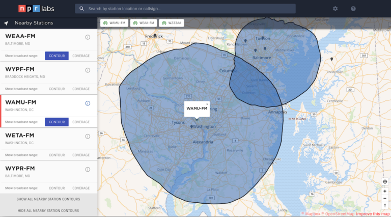
The NPR Labs Mapping & Population System plots NPR and PBS member stations on a map and allows users to view station broadcast ranges, as well as more detailed information from the FCC, NPR, and Census.
The application uses VueJS, MapBox GL JS, and TurfJS to handle data binding, map tiling, and data conversion respectively.
The user experience and interface was designed by Robert Weisbecker.
Data Generation System
To download, format, and merge data from NPR, FCC, and PBS, I wrapped Python and Bash scripts in a Vagrant box to automate the process. The final output includes GeoJSON features for all member stations.